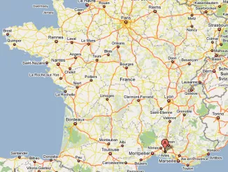
Where is Arles in France? The geographical location of Arles City in France
Arles is located in the south of France in a region called Provence-Alpes-Côte d'Azur (PACA) and a department called Les Bouches-du-Rhône.
The geo coordinates of Arles are : 43°40′41″N 04°37′46″E
Arles is 745 km from Paris the capital of France (about 7 hours by car but 3 hours 30 by TGV train)

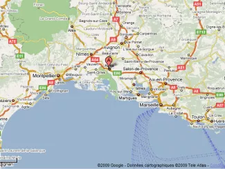
The closest towns to Arles are
- Marseille at 93Km (1 hour driving)
- Aix-en-Provence 78Km (52 minutes driving)
- Salon-de-Provence at 43Km (31 minutes driving)
- Avignon 40Km (44 minutes driving)
- Nîmes 32Km (30 minutes driving)
- Montpellier 78Km (51 minutes driving)
- Barcelona 416KM (3:50 driving)

Where is Arles in France on a Google Maps
About Arles geography
The Rhône river forks into two branches just upstream of Arles, forming the Camargue delta. Because the Camargue is administratively part of Arles, the commune as a whole is the largest commune in Metropolitan France in terms of territory, although its population is only slightly more than 50,000. Its area is 758.93 km2 (293.02 sq mi), which is more than seven times the area of Paris.